
|
location:
Del Mar, CA time: jan 11, 2007 8:07am |
~~ lba ~~ |
-prev next- |
|
I spent the evening in a bar on the 9th. It was in a celebratory mood. The first major day of walking done. I don't recall the name of the bar. I chose it because of its huge windows that were open to the street. It was a shame that they had 10 huge televisions, but these days its hard to find a bar that doesn't have any. I sat next to the window and ordered a pint. 3 mouthfuls later a limo pulled up. I watched as the driver got out and checked the scene. He reported back to the car and out came 4 lovely ladies. They came in and sat next to me. So i chatted them up. I asked the one next to me why the fancy wheels and she shot back "thats how we roll." I laughed. Naturally, I told them all about my adventure. They were intrigued. The girls left halfway through my second pint. They wanted to go see some jazz. I debated going with them but in the end turned down the offer. Its not that I didn't want to party. Its that I just didn't want to have a big blowout and leave at noon the next day. So I finished my pint and went back to the hostel. Slept pretty well. The next day i woke up at 7:30am. I had some free pancakes again and packed my stuff. I was ou the door just before nine. I had a coffee at a local cafe and sussed out a route on the less than detailed map i scored at the hostel. It is a pretty basic map. Not much to it really. it had a few major streets and the highways but nothing of the other roads. It was pretty much usless, but good for staring at blankly. Walking out of downtown was fairly easy. the grid is pretty well laid out. Just past the airport the roads got all screwy and I had to zig-zag again. Frustrating. The useless map had nothing to show for this area. I walked through Olde Towne the birthplace of California. It was there that I asked a cabby for directions. I mostly just wanted to get across the rive that was on the map. According to the map only the i-5 crossed it. The cabby gave me some good directions, and soon i was on the otherside of the river. Now river is a very loose term for this ditch. It was mostly full of grass and tall shrubs. I saw a few puddles but nothing flowing which would indicate a river. Morena Blvd was pleasant. Not because it was scenic, but it was straight and went right where I wanted to go. Which was Rose Canyon. I had ridden the train through it on my way to San Diego and wanted to check it out. There was even a nice trail cut right through. I followed this until I got to La Jolla. Then I had to cut across to the coast so as not to get lost in Suburbia. I still got lost. Stupid windy roads that don't go straight. Which of course weren't on my map. After becoming thoroughly lost I asked for some direction from a gardener. He was of course mexican and "me no speaky English." curses. So i followed my nose to a grocery store. Bought some lunch and asked an English speaking person for direction. The gave me some good advice. Which i didn't follow. 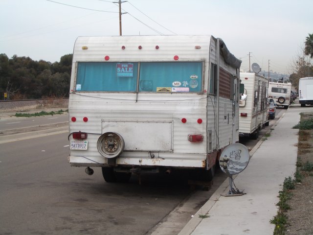 now that's side of the road living I got this idea that i wanted to see the University of San Diego. I really like universities and walking around them pretending that I too am a smarty pants. I figured I would just cut across the campus, as my useless map seemed to tell me that there was a major road around the school. I had the inkling that it was a bad idea right from the start. See the Campus is on this rather large hill. Usually when one goes up a hill they have to come down the hill, and sometimes one side is easier to climb than the other. I threw caution at a hurricane there and went up there anyway. Upon arriving on the other side of the hill I was confronted by steep slope. It was not only steep but covered with all kinds of unfriendly bushes. There were prickly pear, rosemary, and these nasty thorny bushes that I don't want to know the name of. Mingled in with all this snarb were Anise plants they were dry and twiggy and slippery under foot. not just one or two but thousands. the entire slope smelled of black licorice. At first I followed game trails down then the slope got almost vertical. and i had to slide. at one point i slid right into one of those unameable plants. It hurt, and I am still pulling thorns out of my hands. Upon getting down to the road on the other side i was given two choices. right which was the wrong direction or left which was the right one that went right up a huge hill. I opted for the non hill having just experience a very unpleasant time coming down. 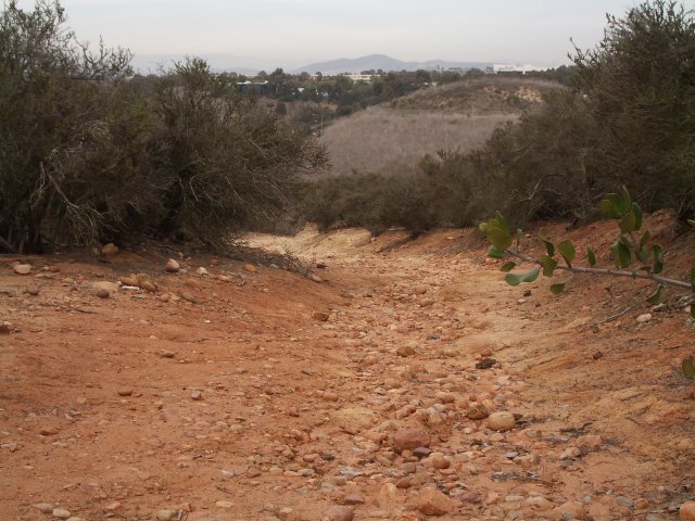 looks pretty innocent here I walked in the wrong direction for thirty minutes before i caved and realized that i was just going to get hopelessly lost if i continued on that course. So I turned around and trudged back up the huge hill. It was worth it though, because when i got to the top there was a spectacular view of the ocean. Some of those red cliffs covered in sage and succulents that you see on postcards. From that point on the rest of the day, which there wasn't much left of, was pleasant. 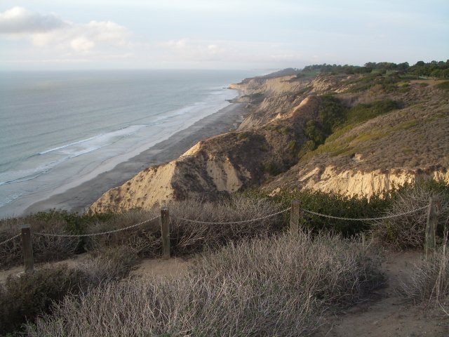 a nice reward I walked through Broken Hill State park. Saw signs that warned of rattlesnakes, and dissallowed camping and picnics. I continued on. The path I walked took me down to ocean level and at around 6:00 i arrived at a bridge that went over a small rivulet coming out of some brackish marsh. I went under the bridge and un packed my gear. It was a pretty safe spot. Outside of any city, in a location people generally drive too, so little foot traffic. I played my harmonica and listened to the waves for the evening. It was pretty peaceful under there. The traffic died off pretty quickly. And I was left with just the sound of the ocean. Disturbed periodically by the US military flying their expensive machines of death around. I woke up to joggers this morning. there was a slight bite to the air and i had to don some sweaters. Its been pretty overcast so far today. Currently I am in a coffee shop in Del Mar taking it easy. I should be on my way in five minutes here |
| -prev | A Californian Saunter | next- |